
Desert Online General Trading LLC
Dubai, United Arab Emirates
Desert Online General Trading LLC
Dubai, United Arab Emirates
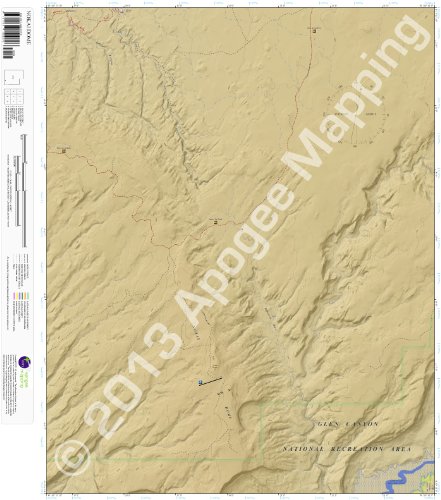
PLEASE READ: All amTopo maps are updated and enhanced replicas of the original USGS 7.5 Minute topographic quadrangle maps. This means they have exactly the same scale (1:24,000), geographic coverage, and map title/name as USGS maps. Please be aware certain recreational features such as lengthy hiking trails may span multiple amTopo maps. If you are unsure what map (or maps) you will need to cover a specific recreational feature, please contact Seller with questions before placing an order. Description: Nokai Dome, Utah 7.5 Minute Topographic Map, waterproof paper edition. Approximate dimensions are 24" x 24". Maps are shipped rolled in durable map tube. Map includes terrain features, roads, trails, recreational facilities, land ownership, navigational collar (latitude/longitude and UTM Grids), compass rose depicting true north and magnetic north, legend, scalebar (miles and kilometers), and overview map. Prominent features: Glen Canyon National Recreation Area, Navajo Indian Reservation, Lake Powell, San Juan River, Nokai Dome, Lake Canyon, Castle Creek, Hole-in-the-Rock Trail, Mormon Trail, Fortress Ruin. Read more
Trustpilot
2 months ago
2 weeks ago